Datasets
Standard Dataset
Dataset - Autonomous Rover Enables Radar Profiling of Ice-Fabric Properties in Antarctica
- Citation Author(s):
- Submitted by:
- Mohammadreza Ershadi
- Last updated:
- Thu, 02/29/2024 - 07:41
- DOI:
- 10.21227/9twx-eb68
- Data Format:
- License:
 154 Views
- Categories:
- Keywords:
Abstract
Ground-penetrating radar is an extensively used geophysical tool in cryosphere sciences (ice sheets and glaciers) with sounding depths of several kilometers due to the small radio-wave attenuation in ice sheets. Detection of the ice thickness and internal ice stratigraphy with commercial radars has become standard. However, there is still an observational gap in determining dielectric and mechanical ice-fabric anisotropy and basal properties using these systems. Recently, ground-based phase coherent radar has shown its potential to fill this gap. However, this requires that the corresponding ground-based radars cover profiles several tens of kilometers in length. We address this challenge by modifying an autonomous rover to collect phase-coherent, quad-polarimetric radar data geolocated with real-time kinematic positioning. In a proof-of-concept study in Antarctica, we demonstrate that this allows the collection of quad-polarimetric data along a 23 km profile, mapping anisotropic ice-fabric properties at <100 m intervals across the transition of grounded to floating ice. This study shows the possibility of collecting data that will refine ice-flow models by providing missing rheological parameters. This work also demonstrates the versatility of the autonomous ground vehicle with its ability to tow more than 200 kg payload, with a battery run time of over six hours, and with a modular design that enables future integration of different radars or other geophysical sensors.
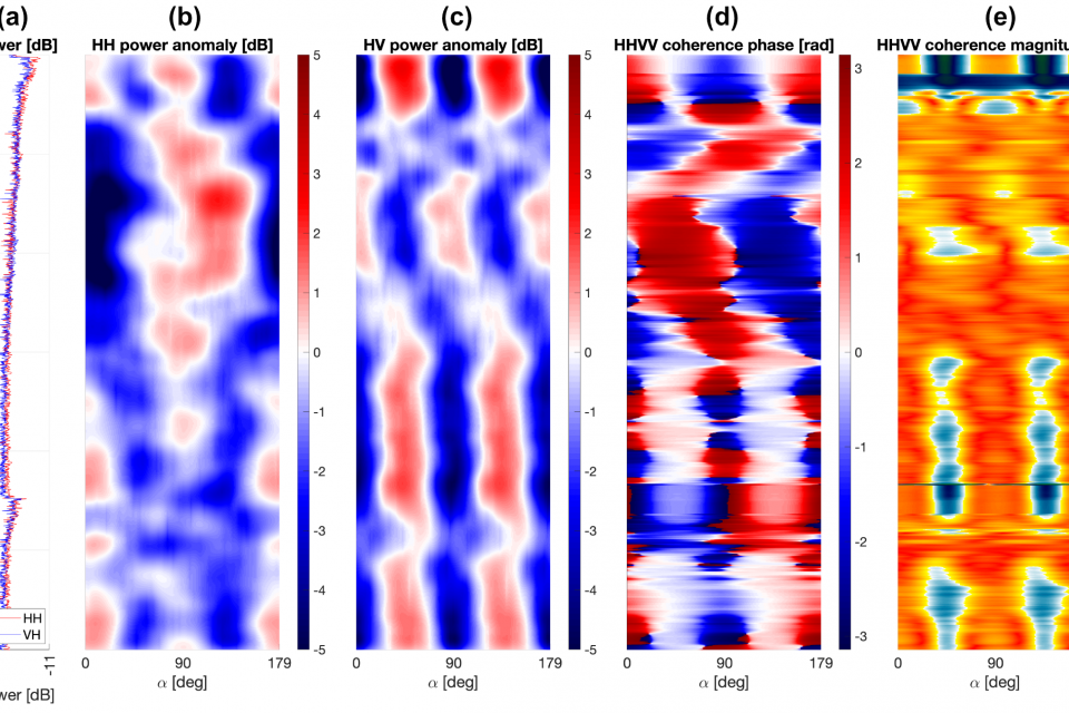
Quad-Polarimetric ApRES data was collected at the grounding zone of the Ekström Ice Shelf. All data along the transect are shown in the form of videos (RoverQP_Point.mp4 and RoverQP_Profile.mp4). Any point where one or more of the recorded signals contain only noise (such as P82, P316, and others) must be excluded from analysis and interpretation. The point number is shown on the top left of the RoverQP_Point.mp4 video.
Dataset Files
- Standard Quad-Polarimetric pRES figures for each measured point in 1fps RoverQP_Point_1fps.mp4 (129.43 MB)
- Standard Quad-Polarimetric pRES figures for each measured point in 15fps RoverQP_Point_15fps.mp4 (144.24 MB)
- quad-polarimetric metrics for the along-flow and across-flow profile (1fps) RoverQP_Profile_1fps.mp4 (31.94 MB)
- quad-polarimetric metrics for the along-flow and across-flow profile (15fps) RoverQP_Profile_15fps.mp4 (42.05 MB)


